Kobe — Why Japan's Great Port City Was Designed, Not Grown
Kobe
By Kei · Born and raised in JapanThe Meaning
Most of Japan's famous cities grew slowly. Kyoto and Nara settled into place over a thousand years, street by street, temple by temple, until the shape of them felt less built than grown — the way a forest is grown. You can feel that long, unhurried accumulation when you walk them.
Kobe is the opposite kind of city, and knowing that changes how you read it.
For most of its history Kobe was not a city at all. It was a small village beside a good natural harbor, in the shadow of a steep green mountain wall. Then, on January 1, 1868 — by the old lunar calendar still in use, the seventh day of the twelfth month of Keiō 3 — its port was opened to foreign trade, one of a handful of ports through which a country that had kept itself closed for two centuries finally let the outside world in. And almost overnight, on the flat land between the mountains and the sea, a new kind of place was drawn.
It was drawn, quite literally. The foreign settlement laid out along the waterfront was not allowed to happen on its own. A British engineer, J.W. Hart, planned it as a single design: a neat grid of streets, more than a hundred numbered plots, a wide central avenue, a green belt and a seaside promenade, with sewers and gas lamps built in from the start. A record of the day called it the best-planned foreign settlement in the East. Where Kyoto accumulated, Kobe was composed — a small European-style town set down, finished, onto Japanese ground in a few short years.
That is the thread that runs through everything you are about to see. The foreign houses on the hill, the Chinatown by the harbor, the world-famous beef, the lights on the mountain at night — none of it is the slow sediment of centuries. It is what happened when a closed country opened one window, very deliberately, and an entire international city poured through it in a single generation. The wonder of Kobe is not that east and west happen to mix here. It is that the mixing was, from the very first day, on purpose.
Keep that in mind as you walk, and a pretty port town quietly becomes something more interesting: a city you can still read like a plan.
What Happens When You're There
Step 1: Up the Slopes of Kitano
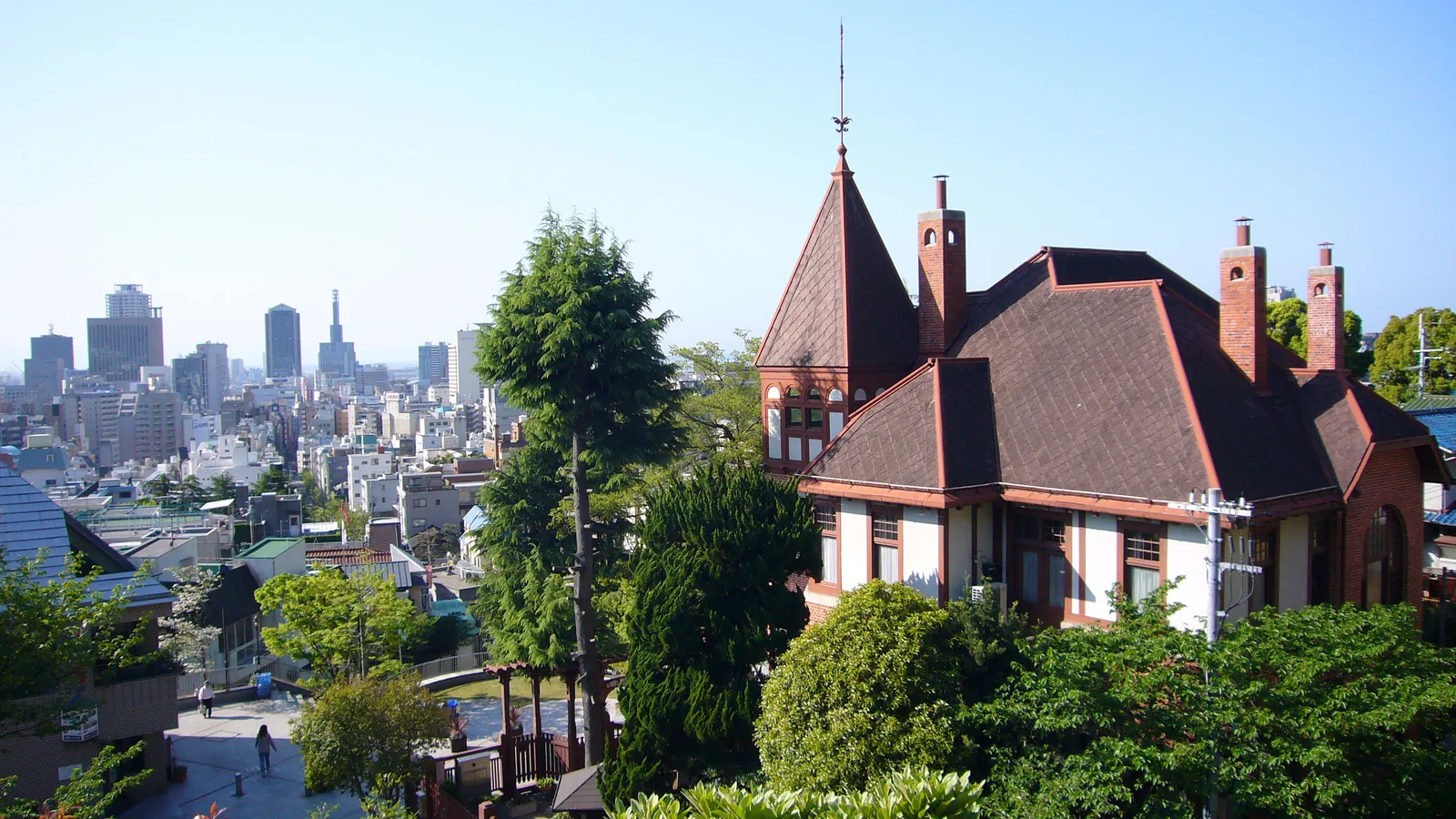
Start by climbing. From the downtown stations around Sannomiya, the land tilts north, and within a few minutes' walk the streets begin to rise toward the mountain. This is Kitano, and the houses you have come to see — the ijinkan, the "foreigners' residences" — stand along these slopes.
There is a reason they are up here, and it is worth knowing before you arrive, because it changes what you are looking at. When the port opened, foreigners were meant to live down in the planned settlement by the water. But the settlement filled, and land ran short, and so they were allowed to build on the gentle hillside above it — drawn partly by the simple fact that the higher you stood, the better you could see the sea. From the late 1880s until the Second World War, more than two hundred Western and Japanese houses went up here, side by side, and the neighborhood grew its own quiet, in-between culture. Today around a dozen and a half of the houses are open to visitors, and the whole district is protected as one of Japan's preserved historic areas.
So these are not film sets, and they were never built to be photographed. They are the houses where the foreign families of a new port city actually lived. The green clapboard of the Moegi House was once the home of an American consul; the red brick and the little weathercock on the roof of the Weathercock House belonged to a German trader. Look closely and you can read the compromise in the architecture itself — European windows and fireplaces fitted to a Japanese hillside and a Japanese climate, neither fully one thing nor the other. Stand at a window where a family from the other side of the world once stood, looking down the slope at the same harbor, and the point of Kitano stops being the photo and starts being the time.
Here is the honest part, so you can arrive expecting it: Kitano is a hill, and you will feel it in your legs. Some of the houses are smaller inside than their famous facades suggest, and you do not need to pay to enter every one — much of the pleasure here is simply walking the lanes, reading the rooflines, letting the neighborhood be the exhibit. If you slow down on a steep stretch to catch your breath, you are in ordinary company; Japanese visitors do exactly the same, on exactly these slopes.
Step 2: Where the City Mixes
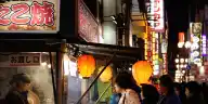
Walk back down toward the water and the city begins to layer. In a few blocks around Motomachi, you pass Japanese shopping arcades, the stone-and-brick remnants of the old foreign settlement, and then, through a bright painted gate, the lantern-hung lanes of Nankinmachi — Kobe's Chinatown.
Nankinmachi exists for the same reason Kitano does: the way the port was arranged. Chinese merchants who came with the opening of Kobe could not live inside the foreign settlement, so they settled just to the west of it, opening shops and kitchens, and the quarter took its name from the crowd of them. It grew, in other words, in the gap left by the rules — which is why, in three short blocks, you can stand in a place that is Japanese and Western and Chinese all at once, with the steam rising off a tray of pork buns. It is counted among Japan's three great Chinatowns, and the simplest way to enjoy it is to eat your way slowly down the middle of it.
A small kindness goes a long way here, and it is the same all over Japan: when you buy something to eat from a stall, it is usually appreciated if you eat it at or near the shop you bought it from, rather than walking and eating through the crowd. (Here's the gentle logic behind that.) No one will scold you. But standing to one side to finish your pork bun is one of those small, easy things that makes the people around you glad you came.
Step 3: Down to the Sea
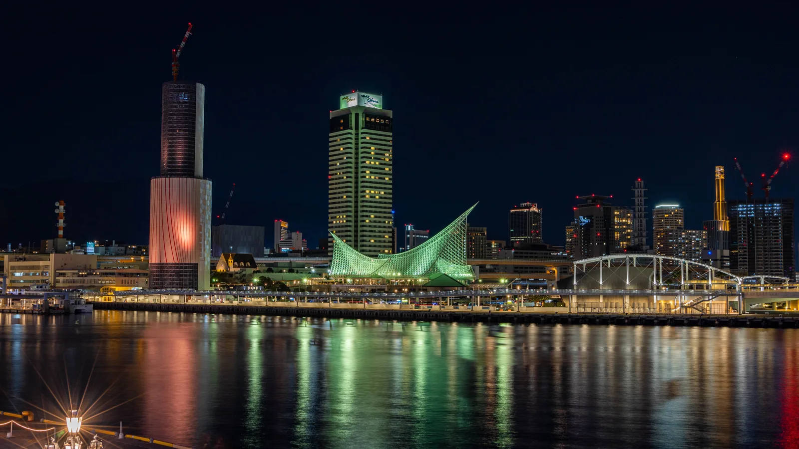
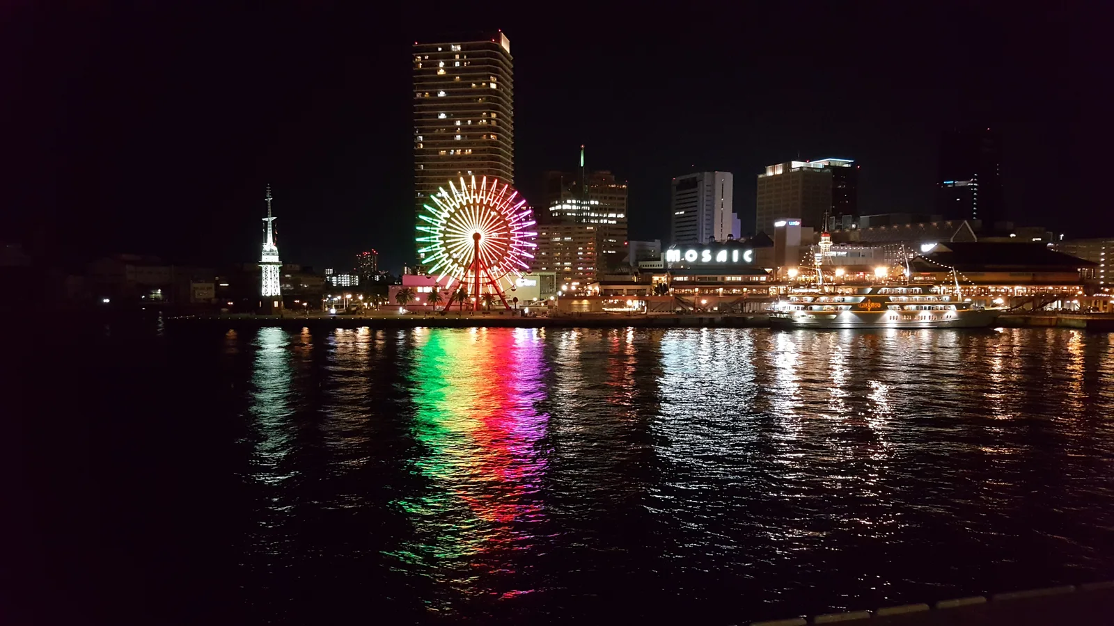
Keep going down and you reach the thing that made all the rest possible: the water. At Meriken Park and Harborland the city meets its harbor in the open — the red steel lattice of the Kobe Port Tower, the wide quay, the cranes and the ferris wheel across the basin. This is the front door through which everything else arrived.
It is also where Kobe keeps its most honest memory. In one corner of Meriken Park, a stretch of the old pier — around sixty meters of it — has been left exactly as the morning of January 17, 1995 left it: the ground buckled and dropped, the lamp posts leaning, the quayside frozen mid-collapse. That morning the Great Hanshin-Awaji Earthquake struck the city, and the port was badly damaged. The choice the city made afterward is the part worth standing with for a moment. The harbor itself was rebuilt and working again within about two years. But this one short length of broken quay was deliberately not repaired — kept, instead, as it was, so that the shaking could be remembered by people who would never feel it. A city that was designed from a blank map also chose, here, exactly what to leave unfixed.
You will see the same memory carried more gently a few steps away, in the low "BE KOBE" letters by the water and, in winter, in the corridors of light the city raises downtown. Kobe does not dwell on the disaster, and neither will this guide. It simply keeps a piece of it in plain sight, near the sea, the way you keep a thing you have decided not to forget.
Step 4: A Taste with a Definition
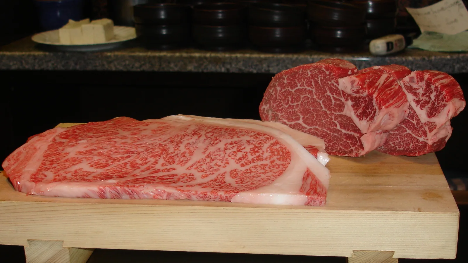
Somewhere in your day — and lunch is often the easier time for it than dinner — you will probably want to eat the thing the city's name is attached to all over the world. It helps to know what that name actually means, because "Kobe beef" is not a description. It is a definition, and a surprisingly strict one.
Real Kobe Beef begins as Tajima cattle: a purebred line of Japanese Black raised, by registered farmers, within Hyogo Prefecture, whose own mountain valleys gave the breed its name. But being Tajima cattle is only where it starts. To be allowed to carry the name "Kobe Beef," the meat from one of those animals must then pass a set of measured thresholds — a marbling score of six or higher, a yield grade of A or B, a carcass weight at or under 499.9 kilograms, and judged fine and firm in texture. Fewer than two in a thousand cattle slaughtered in all of Japan clear that bar. When they do, an inspector presses a small stamp shaped like a chrysanthemum — the official flower of Hyogo — onto the meat, and a numbered certificate of authenticity follows the animal through to the table.
That is why a real Kobe beef restaurant displays a small bronze statuette of a Tajima cow and a membership certificate near its door, and why, if you ask, the staff can usually show you the certificate or the animal's individual ten-digit number. None of this is for show. The whole apparatus exists for a plain reason: when the port opened in 1868 and foreigners discovered how good the local Tajima beef was, the fame ran ahead of any way to prove what was genuine, and decades later the producers built the certificate, the stamp, and the registry precisely so that the word "Kobe" could be trusted. The melt of it on your tongue is not luck and not magic. It is the visible end of a long, deliberate system for making "delicious" repeatable.
The honest note: price runs a wide range, and the gap between a lunch set and a famous dinner counter is large. Plenty of restaurants around Sannomiya serve the certified article at lunch for far less than the evening, and other top grades of Japanese wagyu are wonderful too. You have not failed if you eat Kobe beef at noon, or if you choose a quieter griddle over a celebrated one. Many Japanese diners make exactly those calls.
Step 5: The Lights of the Slope City
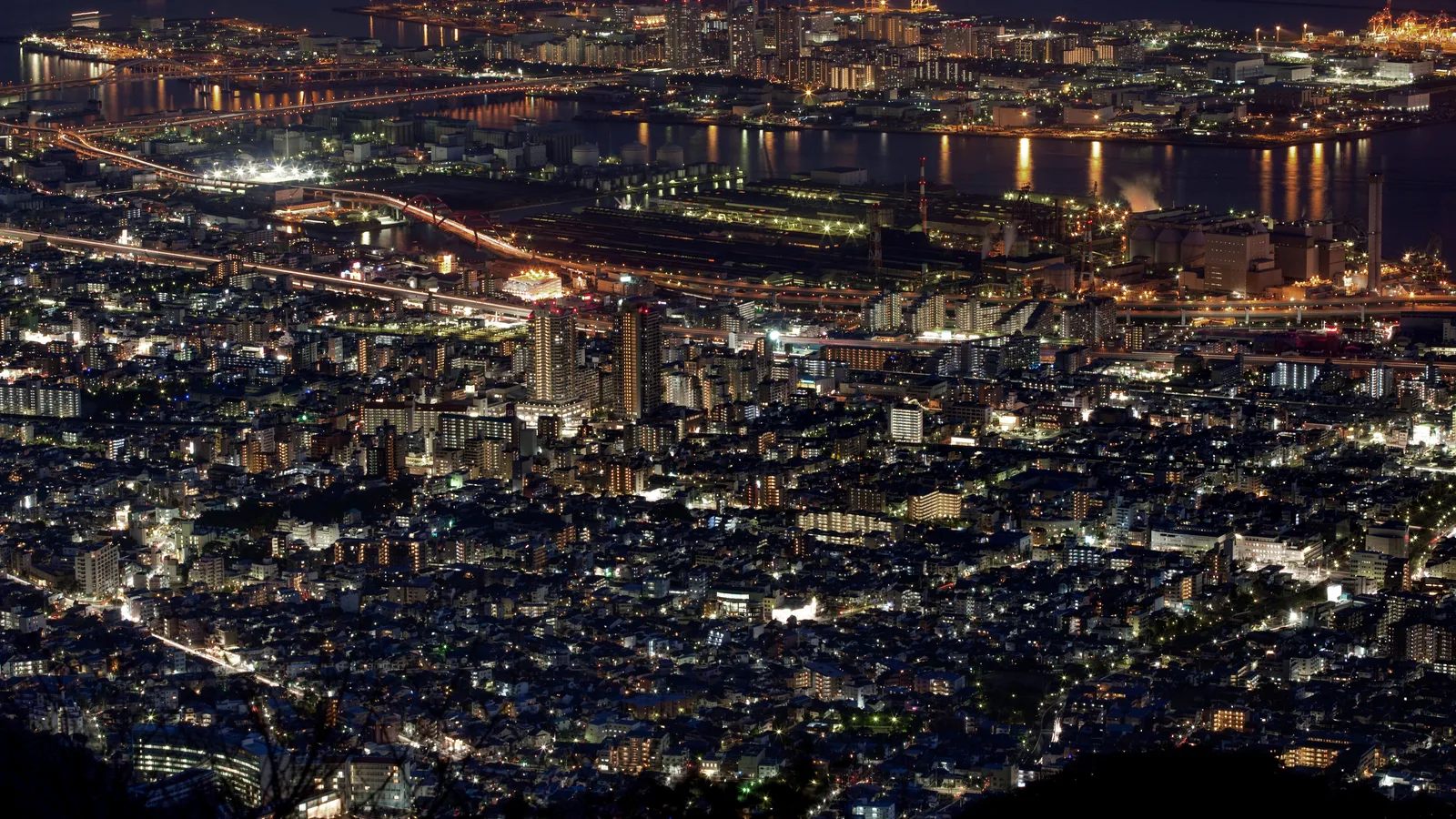
End the day by going back up — much higher this time. Behind the city rises the Rokko range, and from the overlooks along it, after dark, Kobe becomes one of the most famous night views in Japan. From the Kikuseidai terrace on Mt. Maya, more than seven hundred meters up, the whole city pours out below you: a long, dense river of light pressed into the narrow band between the black mountain at your back and the black sea in front. The city itself calls it one of the country's three great night views, a trio it shares with Hakodate in the far north and Nagasaki in the far south.
It is worth understanding why the view is the way it is, because the answer is the same answer as everything else in Kobe. The lights are so concentrated, so sharply edged, because the land is. The Rokko mountains come down almost to the shore, and the whole city — port, settlement, slopes and all — is squeezed onto the thin strip of flat ground between the range and Osaka Bay. You are not looking at a city that spread out comfortably. You are looking at every light a city makes when it has nowhere to spread, packed into the only space the geography allowed. The same narrowness that put the foreign houses up a hillside, and the harbor right against downtown, is the narrowness that makes the night glow the way it does. Stand at the railing and you are reading the shape of the land in light.
Two honest things for the top of the mountain. It is colder up there than in the city below, often by several degrees, so bring a layer even on a mild evening. And the cable car and ropeway that carry you up and down run on a fixed schedule with a firm last departure — and that last car comes early on some days of the week and after dark on others. Check it before you go up, and time your descent to it. The view is worth the trip; being stranded above a sleeping city is a different kind of adventure. Plan the way down before you ride up, and the slope city will hand you its best hour and still get you home.
Good to Know
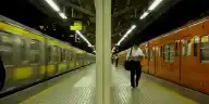
Getting your bearings: the station names. Kobe's downtown has several stations with confusingly similar names, all within a few minutes of each other: JR Sannomiya (written 三ノ宮), Hankyu/Hanshin Kobe-Sannomiya (神戸三宮), and the subway Sannomiya (三宮). Treat all of them as "downtown Kobe." Two names that catch people out: JR Kobe Station (神戸駅) is not the main downtown station — it sits southwest, near Harborland and the port. And Shin-Kobe (新神戸) is the Shinkansen station, one short subway stop north of Sannomiya, right at the foot of the Kitano slopes. Aim for Sannomiya for downtown, Shin-Kobe if you arrive by bullet train. (For how the rail companies and IC cards fit together, see getting around Japan.)
Getting there. Kobe is an easy trip from the Kansai cities. From Osaka, a JR Special Rapid train reaches Sannomiya in roughly 20–25 minutes; the Hankyu and Hanshin lines from Osaka-Umeda take a little longer. From Kyoto, a JR Special Rapid is around 50 minutes. By Shinkansen, Shin-Osaka to Shin-Kobe is about 13 minutes, and every bullet train stops at Shin-Kobe. Last verified: 2026-06. Confirm times on the operators' own journey planners (JR West, Hankyu, Hanshin) before you rely on them.
From Kansai International Airport (KIX). Three ways in: a direct limousine bus to Sannomiya takes about 65–75 minutes (around ¥2,200 one way); the Kobe-Kansai Airport Bay Shuttle, a high-speed boat, crosses the bay to Kobe Airport in about 30 minutes (around ¥1,880, often sold bundled with the onward Port Liner train), then the Port Liner runs to Sannomiya in about 18 minutes; or you can go by rail via Osaka, which is usually the slowest. Last verified: 2026-06.
Getting around the city. The City Loop is a hop-on, hop-off sightseeing bus that links Kitano, Sannomiya, Nankinmachi, and the harbor; a one-day pass is around ¥800 (single ride about ¥300). The subway and the Port Liner cover the rest. Last verified: 2026-06.
Kitano (the ijinkan). Most houses open from around 9:00–9:30; individual admission to a single house is usually a few hundred yen (about ¥500 for the well-known Weathercock House and Moegi House), and several houses are bundled in combination passes — but note there is no single ticket that covers every house, as they are run by different operators. You do not need to enter them all; walking the lanes is free and is much of the experience. Wear comfortable shoes for the slopes. Check current hours and ticket combinations on the official Kobe travel site before you go. Last verified: 2026-06.
The night view (Mt. Maya / Mt. Rokko). The Maya Viewline (a cable car plus ropeway) carries you up to the Kikuseidai overlook on Mt. Maya; it is closed on Tuesdays, and — this is the detail that strands people — the last descending car leaves earlier in the early week (around 17:40 on Mon/Wed/Thu) than on weekends and in summer (around 21:00). A round trip is about ¥1,560. Reach the base by Kobe City Bus #18 from Sannomiya (about 10 minutes). The separate Rokko Cable up Mt. Rokko runs later (last car around 21:10, round trip about ¥1,550), but its base is reached from Rokkomichi/Rokko/Mikage stations one stop east of Sannomiya, not from Sannomiya directly. Always confirm the day's last departure on the operator's site and plan your descent around it. The summit is several degrees colder than the city — bring a layer. Last verified: 2026-06.
Kobe beef. Real Kobe Beef restaurants display a bronze Tajima-cow statuette and a membership certificate, and can show the certificate or the animal's ten-digit ID if you ask — a reliable way to know you have the certified article. Lunch sets are generally far cheaper than dinner for the same grade; reservations are wise at the well-known counters. Restaurants cluster around Sannomiya and Kitano.
Best time and season. The night view is the heart of an evening visit, so a half-day that runs into dusk, or a full day, suits Kobe best — staying one night makes the beef dinner and the mountain view comfortable rather than rushed. In December and into the new year, watch for the Kobe Luminarie, the corridors of light first lit in 1995 in memory of the earthquake; its dates shift year to year, so check before counting on it. Last verified: 2026-06.
Photography. Kitano's lanes and the mountain overlooks are popular, and some streets pass private homes. Step to one side before you stop to shoot so others can pass, and keep doorways and windows of lived-in houses out of your close-ups. (More on reading the room at popular photo spots.)
A note on the region. People often fold Kobe in with Osaka and Kyoto as "Kansai," and there is a warm regional character the three share; if that's what you're curious about, it has its own story. This guide stays with Kobe the city. And if you're building a Hyogo itinerary, the prefecture rewards two very different days: the open port here, and inland, the great wooden keep of Himeji Castle.
Official website: feel-kobe.jp
If Things Don't Go as Planned
You came mostly for the beef, and you're wondering if the city is worth the trip. It's a fair question, and a common one — you can eat certified Kobe beef in Osaka or Tokyo too. What Kobe the place adds is the why behind the name: the planned port, the hillside houses, the harbor, the mountain of lights — the whole designed, opened city that the beef is only one product of. If you treat Kobe as a city to read rather than a single meal to eat, the day pays you back.
Kitano felt like "just a few old houses," and it's uphill. The slopes are real and some interiors are modest — this surprises people. The trick is to stop treating the paid houses as the point. Walk the lanes, read the architecture, find the one or two houses whose story pulls you in, and skip the rest. The neighborhood, not the ticket, is the experience, and the streets cost nothing.
You're worried about getting stranded at the night view. This is the single most common Kobe mishap, and it is entirely avoidable. The mountain cable cars stop running on a fixed schedule, and the last car can be surprisingly early on Mondays, Wednesdays, and Thursdays. Decide your descent before you ascend, note the last departure, and if you're also catching a train back to Osaka or Kyoto, work backward from that. Mt. Rokko generally runs later than Mt. Maya if you want a longer evening.
The mountain is colder than you expected. The overlooks sit several hundred meters up, and the temperature drops with them. Carry a layer even on a warm evening; the view is best lingered over, and you'll linger longer if you're warm.
The station names have you turned around. You're not the only one — even Japanese travelers double-check. Remember just two things: "Sannomiya," in any of its versions, is downtown; "Shin-Kobe" is the bullet-train station near Kitano. Plain "Kobe Station" is down by the harbor and is rarely where you want to start.
You only have half a day. That's enough for a real taste of Kobe. A good half-day: come in to Sannomiya, walk up into Kitano, down through Motomachi and Nankinmachi, and out to Meriken Park by the water. Add a Kobe beef lunch and you've seen the spine of the city. Save the mountain night view for an evening when you can give it the time — and the careful timing — it needs.
Sources:
- FEEL KOBE — Kobe Official Travel Guide (Kobe Tourism Bureau) — Kitano ijinkan district and named houses, Nankinmachi (one of Japan's three great Chinatowns), Meriken Park and Harborland, Mt. Maya Kikuseidai night view ("one of Japan's three great night views," 702 m), Kobe Port Tower, City Loop bus, model itineraries, and the Kobe Luminarie
- City of Kobe — Kitano-cho / Yamamoto-dori Important Preservation District and port history — Port opened January 1, 1868 (Keiō 3, lunar 12th month, 7th day) as modern Kobe's beginning; the foreign settlement laid out as a European-style grid by British engineer J.W. Hart; foreigners building on the Kitano slopes from the late 1880s; 200-plus houses before the war; the 1995 earthquake and the district's preservation
- Kobe City Archives — Formation of the Foreign Settlement — The planned settlement (22 blocks, 126 plots, ~20 m central avenue, coastal promenade, sewers and gas lamps), the contemporary record praising it as the best-designed settlement in the East, and the mixed-residence zone on the slopes
- City of Kobe — Kobe Port history (opening date and earthquake recovery) — The dual-calendar opening date (January 1, 1868 Gregorian = Keiō 3.12.7 lunar), opened "as Hyogo," and the port's restoration within about two years after the 1995 Great Hanshin-Awaji Earthquake
- City of Kobe — Kobe Earthquake Memorial Park, Meriken Park — About 60 meters of the Meriken pier preserved as it stood after the January 17, 1995 earthquake; opened 1997, renewed 2025
- Kobe Beef Marketing & Distribution Promotion Association — official definition and certification — Kobe Beef as certified Tajima cattle (Japanese Black) born and raised in Hyogo, heifer or steer, meeting BMS No. 6 or higher, yield grade A or B, carcass weight 499.9 kg or less, fine and firm texture; the chrysanthemum (nojigiku) certification stamp; the certificate of authenticity; the bronze statuette and membership certificate at designated stores
- Kobe Beef Association — FAQ and council purpose — Kobe Beef as fewer than about 0.2% of Japan's beef; the relationship between Tajima cattle and certified Kobe Beef; the individual ten-digit identification number and traceability; the association established to define and prove genuine Kobe Beef
- Maya Viewline (cable car and ropeway), official operator — Mt. Maya Kikuseidai access, Tuesday closures, seasonal last-descent times, and round-trip fares
- Rokko Cable, official operator — Mt. Rokko cable car hours, last departure, fares, and access from Rokkomichi/Rokko/Mikage
- Kobe Port Tower, official site — Reopened 2024, the red steel-lattice tower and rooftop deck, hours and admission
- JNTO (Japan National Tourism Organization) — Kobe — Kobe between the mountains and the sea, Kobe beef and Tajima cattle held to a strict standard, Kitano's ijinkan ("foreign residences"), Nankinmachi, and the night view from the Rokko range
Image credits: Hero and thumbnail (Kobe Harborland at night) by Brett Fagan (CC0) via Wikimedia Commons. Kitano Weathercock House by 663highland (CC BY 2.5); Meriken Park and Kobe Port Tower by Naokijp (CC BY-SA 4.0); Kobe beef by Orlando G. Calvo (CC BY-SA 3.0); Kobe night view by Laitr Keiows (CC BY-SA 3.0) — all via Wikimedia Commons, cropped and resized.
Real voices
Is it worth it?
Were you there? Share your photos.
Your photo could appear in this guide — with your name and a link to your profile.
Submit a photoRelated Articles
Getting Around Japan: The Tiny Things That Earn You a Nod
Is It Rude to Eat While Walking in Japan? — What Japanese People Actually Think
"Excuse Me, Can You Take My Photo?": What Japanese People Really Think
More guides in Kansai
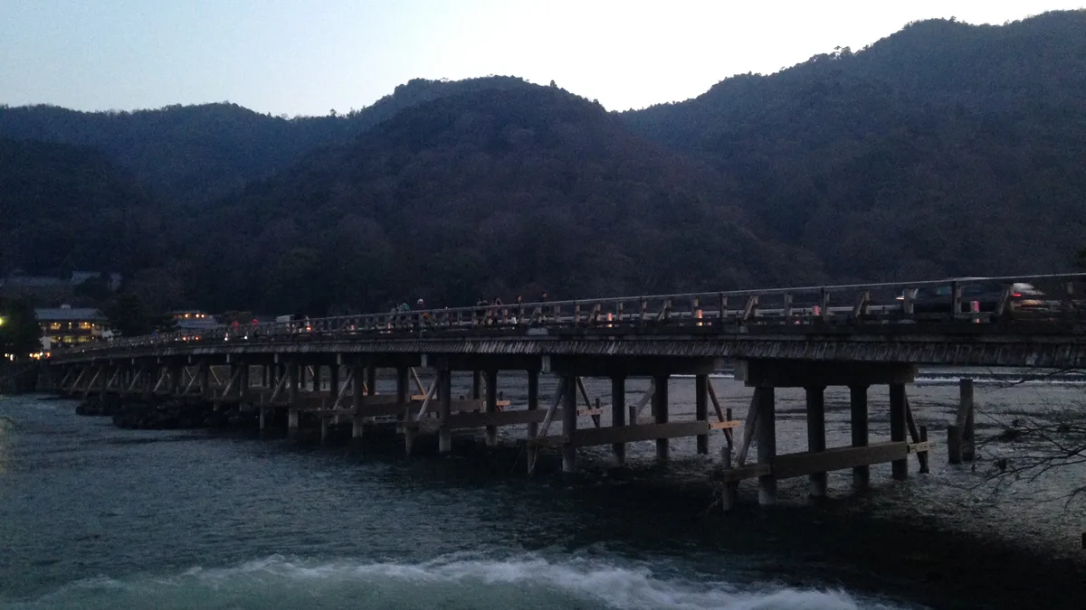
Arashiyama — Why Japan Lists This Bamboo Grove Among the Sounds Worth Saving
An audio cultural guide to Arashiyama in Kyoto, verified against official sources. Understand why Japan lists the bamboo of Sagano among the sounds it wants to keep, how the Moon-Crossing Bridge earned its name, and how to walk the river, the grove, and Tenryu-ji's borrowed-mountain garden away from the crowds.
Arashiyama
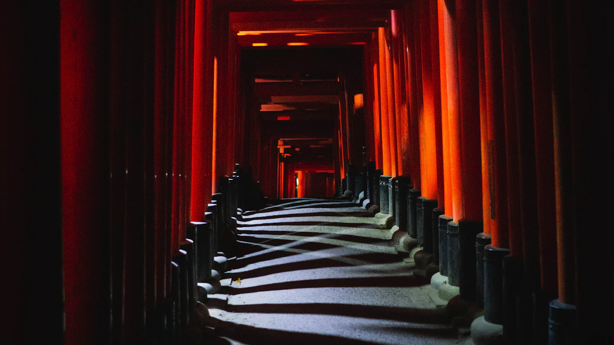
Fushimi Inari Taisha: Ten Thousand Gates, Each One a Thank-You
The ten thousand vermilion gates at Fushimi Inari are thank-you notes you can walk through. A cultural audio guide verified against official sources: why the foxes are messengers not gods, why the summit has no view, and how to walk past the crowds.
Fushimi Inari Taisha
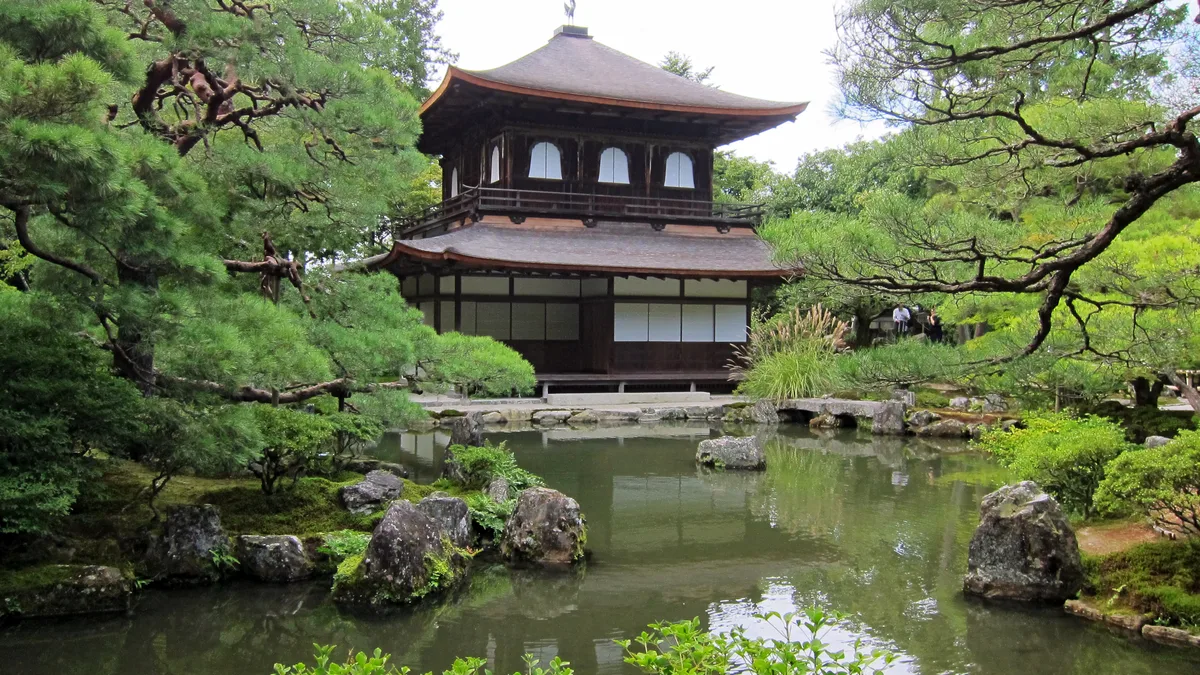
Ginkaku-ji — Why the Silver Pavilion Has No Silver, and Why Japan Finds That Beautiful
Why the Silver Pavilion has no silver — a free audio guide to Ginkaku-ji, Kyoto, verified against official temple sources. Higashiyama culture and the art of restraint, the sea of silver sand, hours, admission (1,000 yen), access from Kyoto Station, and the Philosopher's Path.
Ginkaku-ji (Jishō-ji)
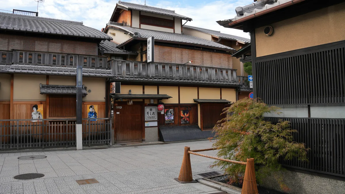
Gion — Walking Kyoto's Flower District, a Town That Is Still Lived In
An audio guide to Kyoto's Gion flower district: what geiko and maiko really are, the walk from Yasaka Shrine through Hanamikoji to the Shirakawa canal, when to go, and how to enjoy a town still lived in.
Gion