Mount Aso — The Volcano You Stand Inside, and the Grassland Kept Alive by Fire
Mount Aso (Aso Caldera)
The Meaning
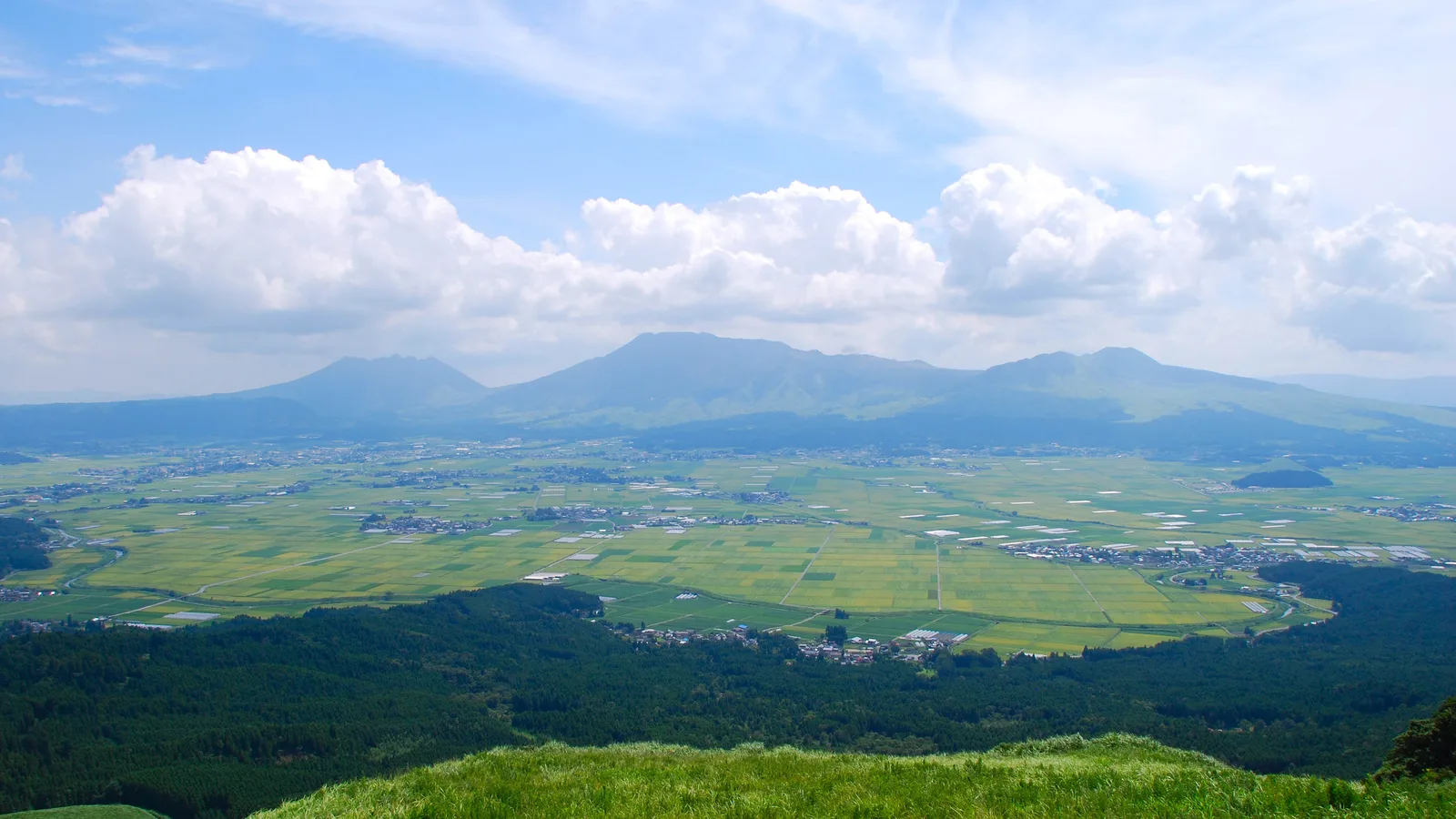
Stand on the northern rim of Aso, at the lookout called Daikanbo, and the first surprise is that you are looking down. Most volcanoes you crane your neck to see. Here the mountain opens away beneath your feet into a vast green bowl, and at the bottom of it — impossibly — is a town. Roofs, rice fields, a railway line, school grounds, threads of road. People live down there, inside the volcano.
What you are standing on the edge of is not a peak but a caldera: the giant basin left behind when an enormous volcano collapsed in on itself. Aso's is around eighteen kilometers across one way and twenty-five the other, ranking among the largest in the world, carved by four colossal eruptions between roughly 270,000 and 90,000 years ago — the last so violent that its ash fell across almost all of Japan. And in the floor of that ancient wound, around fifty thousand people now live their whole lives. Japan's environment ministry notes something quietly astonishing about this: nowhere else on Earth have people built stable towns inside a caldera. Aso is the only one.
Then there is the green. The grassland rolling across the bowl and up the outer walls looks like wild nature at its most generous — and it is almost entirely the work of human hands. Left alone, in Japan's wet climate, this land would turn back into forest within a few decades. It stays open grassland for one reason only: every spring, the people of Aso set it on fire. They have done so, in some form, for around a thousand years. The most natural-looking landscape in Kyushu is, in truth, a thing people keep alive on purpose — by burning it, grazing it, and refusing to let the forest take it back.
There is a story the people here tell about how the bowl became livable in the first place. A deity named Takeiwatatsu-no-mikoto — remembered as the father of Aso — is said to have kicked through the outer rim to drain the lake that once filled the caldera, letting the water rush out so that fields and homes could take its place. You do not have to believe the myth to feel its truth standing at the rim: everything below you, the farms and the town and the green, exists because, long ago, people decided to make a life inside a volcano — and then worked, every year, to keep it.
What Happens When You're There
Step 1: Standing on the Rim, Looking In
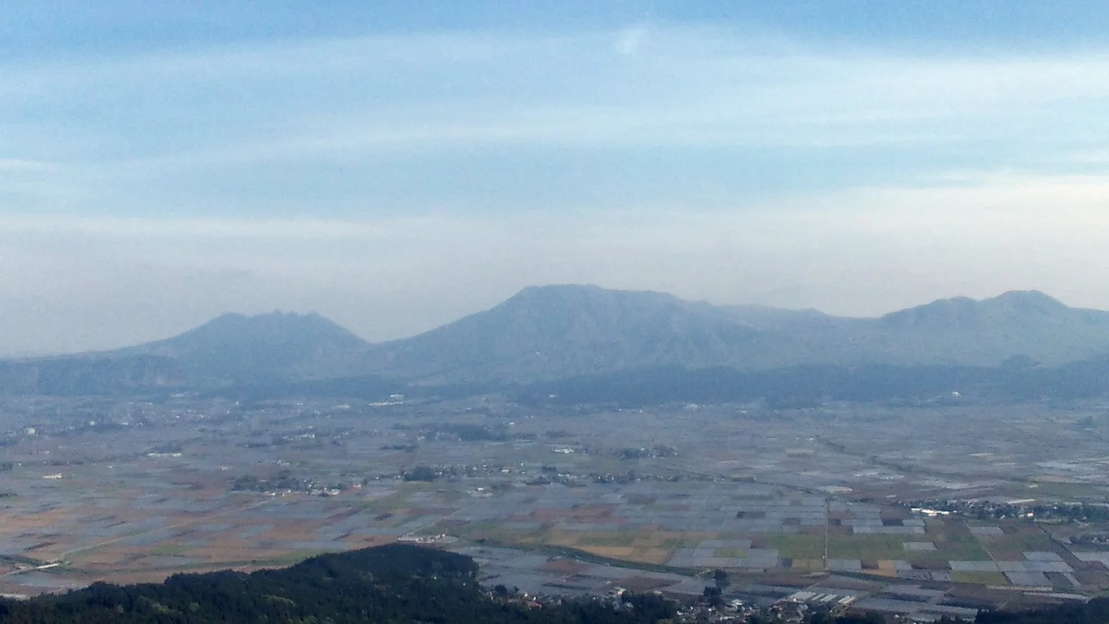
Begin where the whole place makes sense at a glance: up on the rim. Daikanbo, the highest point of the northern outer wall at 936 meters, looks straight across the caldera at the five central peaks — Takadake, the tallest at 1,592 meters; the smoking Nakadake; and three more — which, seen from here, are said to lie together like a great reclining Buddha asleep on his back. Below them spreads the patchwork of the Aso valley, farms and roofs scaled suddenly small by the size of the bowl that holds them.
If you can, come at dawn in autumn. On a cold, still, clear morning after a damp evening, a sea of clouds often pools in the caldera, and the five peaks rise from it like islands from a white ocean. It does not happen on command — it needs the temperature to drop, the air to settle, the sky to clear, all at once — and that is exactly why people who catch it never forget it. If the cloud does not come, the view is still the lesson Aso wants you to learn first: you have not come to climb a mountain. You have come to look into one, and to see that someone lives there.
Getting up here is its own small adventure. Aso is wide and its public transport is thin, so many travelers rent a car; reaching Daikanbo, the grassland, the crater, and the shrine in a single day is far easier on four wheels than by bus. If you would rather take the train and let someone else drive the rest, that works too — it just asks for a little planning, which is its own quiet skill in Japan.
Step 2: The Grass People Keep Alive with Fire
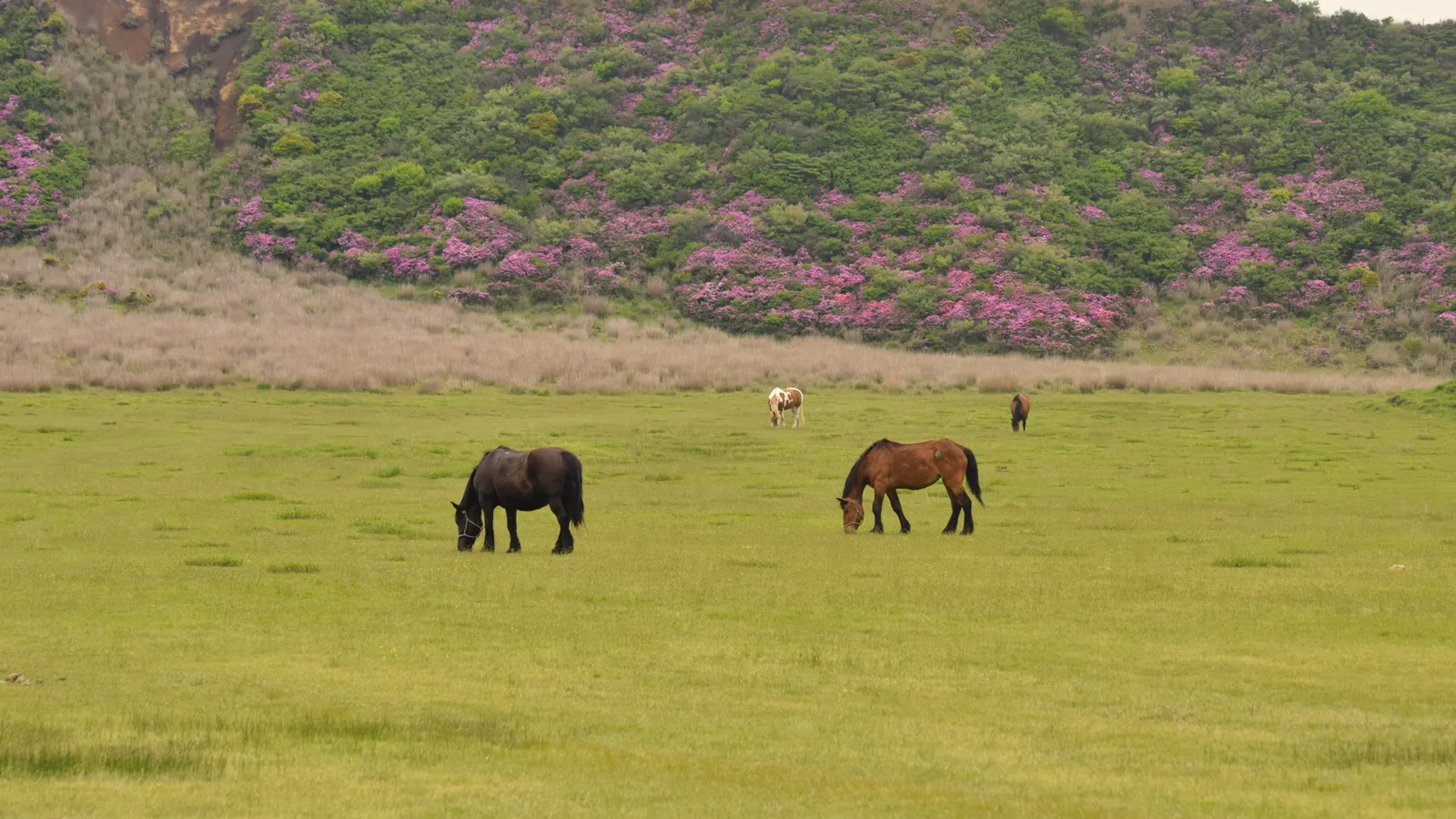
Drive or ride up toward the central peaks and the land opens into Kusasenri — a kilometer-wide grass-floored crater, ringed by gentle slopes, with horses grazing beside still ponds and the peak of Eboshidake behind. It is the picture on every Aso postcard, and almost no guidebook tells you the one thing that makes it remarkable: it should not be here.
This is grassland that nature, left to itself, would erase. The climate of Japan grows forests; an open meadow this size, this high, survives only because people keep cutting the young trees back before they can take hold. Their oldest and most dramatic tool for it is fire. From late winter into spring — most years in March, around the equinox — farmers and a small army of volunteers set the dry grass alight in a controlled burn called noyaki, racing flames across the slopes to clear the scrub while leaving the roots and seeds safe in the cool earth below. Before it, they cut firebreaks by hand: ribbons of cleared ground that, across the whole of Aso, run for hundreds of kilometers. Then, through the warm months, red akaushi cattle are turned out to graze, eating down what the fire left — so that the meadow stays a meadow for one more year.
It is hard work, and there are fewer hands for it every year as the old farming families age. So city people now come out each spring to help carry the fire, in a custom barely a generation old, because the alternative is to watch a thousand-year-old landscape close over. Stand in Kusasenri and let that settle. The green you are admiring is not scenery that happened. It is scenery that is kept — a quiet agreement, renewed every spring with fire, between the people of Aso and the slope of a volcano. It is why this farming landscape was recognized in 2013 as a Globally Important Agricultural Heritage System: not for what grows here, but for the way people have learned to grow it.
Step 3: The Crater You Visit Only When the Mountain Allows
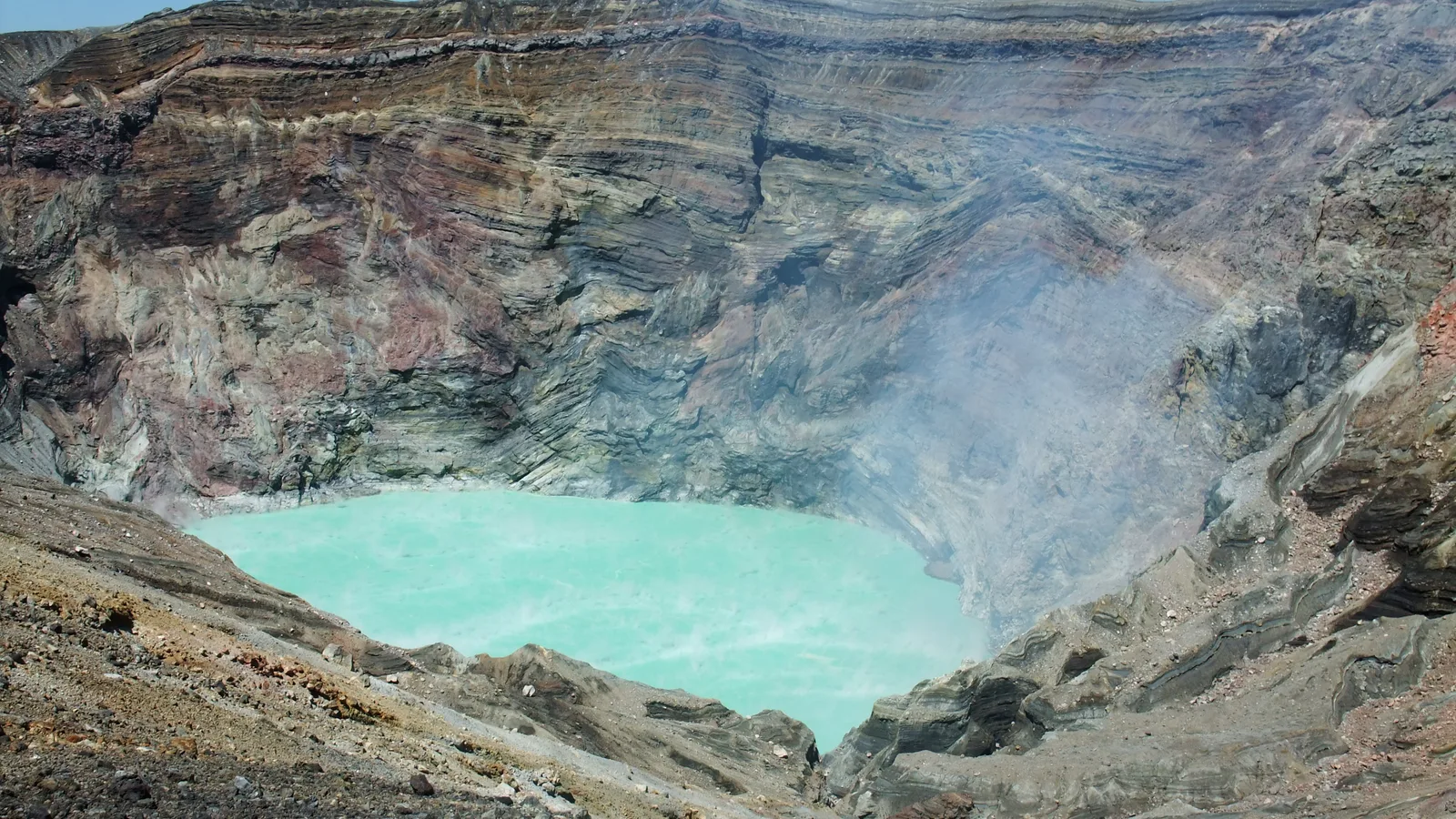
At the heart of it all is Nakadake, and it is alive. From the rim of its active crater, white steam and volcanic gas pour up off a pool of pale, acid turquoise, and the air carries the sharp bite of sulfur. It is one of the few places in the world where you can stand at the lip of a working volcano and look in — when it lets you.
That last part is the whole point, and it is where Aso surprises people most. The crater is not an attraction that is simply open. Whether you can approach it is decided, day by day, by the mountain: by how much gas it is breathing out, and by the official eruption alert level set for it. When the level rises, the area within roughly a kilometer of the crater closes, and the visit is off. This is not rare, and it is not a failure of your trip — it is what living beside a working volcano actually means. (The old ropeway that once carried people up no longer runs; today you reach the crater by a toll road or a short shuttle bus, and only when the road is open.) Because the gas can genuinely harm you, the authorities ask anyone with asthma, a bronchial or heart condition, or who simply feels unwell to stay away from the crater rim, and shelters stand near the edge in case the wind shifts.
So before you set out, check the day's status — the people of Aso publish it, because they live by it — and hold the crater lightly. If it is open, you will stand somewhere very few mountains allow. If it is closed, you have lost nothing that matters: the grassland, the rim, the black volcanic desert of Sunasenri nearby, and the bowl itself are all still here. Treating an active volcano with this kind of patience is not so different from the calm, prepared way Japan tends to handle its own natural risks — not with fear, but with good information and a clear plan.
Step 4: The Shrine in the Bowl
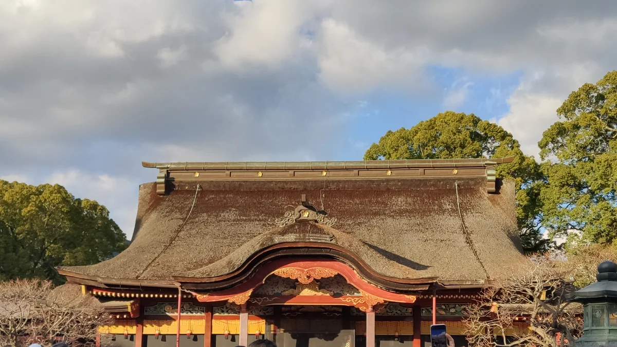
Down on the caldera floor, in the town of Ichinomiya, stands Aso Shrine — and it belongs to this story as much as the crater does. For more than two thousand years, people here have worshipped the volcano itself: the shrine's deities are led by Takeiwatatsu-no-mikoto, the same figure said to have drained the caldera lake, and an upper shrine high on the mountain still faces the crater's steaming pool as its sacred heart. This is what it looks like to live inside a volcano for that long — not to conquer it, but to enshrine it.
The shrine carries a more recent memory too. In the 2016 Kumamoto earthquakes, its great two-storey gate — a romon some eighteen meters tall, among the largest in Kyushu — collapsed, along with much of the rest. What the people of Aso did next is the quiet heart of the place: they rebuilt it. Over seven years, with care, they raised the gate again, reusing around seventy percent of the original timber and adding new strength against the next quake, and the restoration was completed in December 2023. To stand before it now is to look at the same wood that fell, set back upright by hands that refused to let the loss be final. If you visit, a few simple, unhurried courtesies are all it asks — the same gentle customs that make any shrine or temple in Japan easy to enter with confidence.
The wheel closes here. The fire keeps the grass; the grass feeds the akaushi cattle, whose rich red beef is the taste of the region; the cattle keep the grass; and the shrine holds the whole arrangement sacred — fire, grass, cattle, mountain, and people, turning together inside one collapsed volcano. None of it is wilderness. All of it is a relationship.
Step 5: Leaving the Bowl
Before you climb back out over the rim, stop once more and look down. By now the strangeness has turned into something steadier. You came expecting a volcano and found a place where people have, for a thousand years and more, done the patient work of living inside one — burning the grass each spring so it stays green, going up to the crater only on the days the mountain allows, and, when the earth shook their shrine to the ground, simply building it back.
You do not need the crater to be open, or the sea of clouds to appear, to understand Aso. Stand on the rim, look at the green bowl with the town at the bottom of it, and you have already felt the whole of it: not a mountain to be climbed, but a volcano people made into a home — and keep making, every single year.
Good to Know
Getting there: Mount Aso sits in the center of Kyushu, in Kumamoto Prefecture, and the gateway is the city of Kumamoto. The JR Hohi Line runs east from Kumamoto into the caldera; a local train (changing at Higo-Ozu) reaches Aso Station in about an hour and a half, while the limited-express sightseeing train Aso Boy!, which runs on selected days, makes it in a little over an hour. The line itself is a small monument to the area's resilience: the 2016 Kumamoto earthquakes severed both this railway and the main highway into Aso, and both were painstakingly rebuilt — the railway fully reopened in 2020, and Route 57 with a new Aso Ohashi bridge soon after. For the wider picture of trains, passes, and connections, see getting around Japan.
Getting around the caldera — and whether you need a car: Aso is large and its sights are far apart, so a car makes the day much easier; the official tourism guidance says as much. Without one, it can still be done: the Sanko bus Aso Tozan line links Aso Station with the Kusasenri grassland and the Aso-sanjo terminal, where the crater shuttle connects. But the buses are infrequent, and stringing together the rim lookout at Daikanbo, the grassland, the crater, and the shrine in a single day by public transport takes real planning. If you have only one day and no car, choose two or three stops rather than chasing all of them.
The Nakadake crater — check before you go: Whether you can approach the active crater depends on the day's volcanic gas and the official eruption alert level, and the area closes whenever the level rises. Always check the current status before setting out — the Aso Volcano Disaster Prevention Council publishes the live crater-access status, and the Japan Meteorological Agency publishes the alert level. When it is open, the crater is reached by the toll Aso Volcano Park Road (around ¥1,000 for a car) or by the crater shuttle bus (about ¥800 one way) from the Aso-sanjo terminal; viewing the crater itself is free. People with asthma, bronchial or heart conditions, or who feel unwell are asked not to approach the crater rim because of the gas.
The grassland and the lookouts: Kusasenri, the kilometer-wide grass crater below Eboshidake, and Daikanbo, the northern rim lookout, are open and free year-round, and neither depends on the crater being accessible. Komezuka, a near-perfect grassy cone about 80 meters high formed some 3,000 years ago, is admired from the roadside (you cannot climb it — it is a protected natural monument). The sea of clouds at Daikanbo is most likely on cold, clear, windless autumn mornings after a damp evening; live cameras posted by Kumamoto's tourism service let you check conditions before a pre-dawn drive.
The noyaki burning: The controlled grassland burn happens from late winter into spring, most often in March. It is demanding, carefully managed work, not a spectator show — the burns and firebreaks are run by farmers and trained volunteers, and the public watches only from designated safe places. If your visit overlaps it, ask the local tourism association where it can be safely seen.
Aso Shrine: The shrine is in Ichinomiya, a short walk from Miyaji Station on the Hohi Line, and is generally open through the day; entry to the grounds is free. The rebuilt romon gate, completed in December 2023, is the thing to see. Visiting follows the same simple shrine courtesies used across Japan.
When to go: Aso is a year-round destination, but each season shows a different bowl — fresh green grassland in summer, golden pampas grass and the best sea-of-clouds odds in autumn, snow on the rim in winter, and the blackened slopes of the spring burn turning green again by early summer. The caldera floor, the rim, and the crater can differ sharply in temperature and wind, so bring a layer even in summer.
Last verified: 2026-06
Official websites: aso-volcano.jp (live crater-access status), city.aso.kumamoto.jp (toll road, fees, hours), asocity-kanko.jp (Aso tourism), and asojinja.or.jp (Aso Shrine)
If Things Don't Go as Planned
The crater is closed. This is the most common surprise at Aso, and it is worth saying plainly: the active crater is shut whenever volcanic gas or the alert level make it unsafe, and that can happen with little notice. It is not a wasted trip. The crater is one stop among many — the rim view at Daikanbo, the grassland at Kusasenri, the cone of Komezuka, the moon-like sand of Sunasenri, and the shrine are all unaffected, and together they are the real substance of Aso. The people who live here plan around the mountain's moods as a matter of course; borrowing their patience is the surest way to enjoy the place.
You paid for the shuttle or road and then the crater closed. Because conditions can change within a day, access can be suspended after you have already set out and paid, and the fare is generally not refunded in that case. It feels unfair in the moment, but it is the honest cost of a living volcano. Check the day's status one more time right before you commit, and treat reaching the rim as a bonus rather than the whole plan.
The weather wiped out the view. Aso sits high and open, and fog or low cloud can erase the lookouts entirely — and the same fog makes mountain roads genuinely hazardous, so do not push on through it. If the rim is socked in, drop down onto the caldera floor instead: the shrine, the small towns, an akaushi lunch, and a quiet onsen are all good weather. The view will likely be back tomorrow.
There was no sea of clouds. It is never guaranteed — it needs a precise run of cold, damp, still, clear conditions, which is exactly why it moves people when it appears. Check the live cloud cameras before a pre-dawn start so you are not driving up on hope alone, and remember that the daytime view from Daikanbo, cloud or no cloud, is reason enough to be there.
You expected a ropeway to the crater. The old Aso ropeway no longer runs. Today the crater is reached by the toll road or the shuttle bus from the Aso-sanjo terminal, and only when the road is open — so plan around the bus and the day's access status, not a cable car.
You only have time for one thing. Make it the rim. Standing at Daikanbo and looking down into a living caldera with a town in the bottom of it tells you, in a single view, what Aso is — and it is open and free whether or not the crater is.
Sources:
- Aso Geopark — Official (UNESCO Global Geopark) — Caldera dimensions (≈18 km east–west × 25 km north–south, among the world's largest), formation by four giant eruptions between ~270,000 and ~90,000 years ago, the ~90,000-year eruption reaching beyond Kyushu, the five central peaks, and the population living inside the caldera
- Aso City Official — Mount Aso — Outer-rim scale and circumference, "double volcano" structure, Nakadake crater dimensions, and the tens of thousands living on the caldera floor
- Aso Volcano Sanjo Visitor Center — Climbing Information — Elevations of the five peaks: Takadake 1,592 m (highest), Nakadake 1,506 m, Nekodake 1,433 m, Eboshidake 1,337 m, Kishimadake 1,326 m; the "reclining Buddha" view from the north
- Ministry of the Environment — Aso-Kuju National Park (Sustaining the Grasslands, EN) — The grasslands as human-maintained ("if left unattended, they would turn into forests"), maintained by noyaki burning, grazing, and cutting; "thousand-year-old grasslands"; coexistence of people and nature
- Ministry of the Environment — Aso-Kuju National Park (Grassland conservation, JP) — Noyaki as the spring burn that prevents forest succession and feeds livestock; the hand-cut wachikiri firebreaks totaling hundreds of kilometers across Aso
- MAFF — Aso Region, Globally Important Agricultural Heritage System (GIAHS) — Designation in May 2013 as "Managing the Aso Grasslands for Sustainable Agriculture"; grasslands maintained by burning, grazing, and harvesting
- Aso Green Stock — Open Burning (Noyaki) Support — Volunteer noyaki support since 1999 amid an aging farming population; the grasslands kept "for a thousand years by human hands"
- Aso City Tourism Association — The Thousand-Year Grassland — Grasslands present for roughly 13,000 years and not self-sustaining in Japan's climate; maintained by people through burning, grazing, and cutting
- Aso Shrine — Official (About / Restoration) — Deities led by Takeiwatatsu-no-mikoto and the volcano-worship tradition; six structures designated Important Cultural Properties (2007); the ~18 m romon gate; collapse in the 2016 Kumamoto earthquakes and the restoration completed December 2023, reusing ~70% of the original timber
- Aso Volcano Disaster Prevention Council — Crater Access & Safety — Live crater-access status; closure within ~1 km when the eruption alert level rises; the gas warning for people with asthma, bronchial or heart conditions, or who feel unwell
- Japan Meteorological Agency — Aso Volcano Activity — Official eruption alert level for Aso
- Aso City Official — Crater Viewing & Toll Road Fees — Aso Volcano Park Road toll (≈¥1,000 for a car), opening seasons and hours, and that access is suspended during volcanic regulation
- Sanko Bus — Aso Crater Shuttle — The crater shuttle bus replacing the former ropeway: route, ~5-minute ride, and ≈¥800 one-way fare
- JNTO / National Parks of Japan — Aso-Kuju (Explore & Story) — Standard English terms (Mount Aso, Aso Caldera, the five peaks, Daikanbo, Kusasenri, Komezuka, the controlled burn called noyaki, Akaushi cattle) and that the crater is reached by car or shuttle bus
Image credits: The Aso caldera (hero & thumbnail) — photo by Miya.m, CC BY-SA 3.0, via Wikimedia Commons. The five peaks from Daikanbo — photo by STA3816, CC BY-SA 3.0, via Wikimedia Commons. Grazing horses at Kusasenri — photo by Raita Futo, CC BY 2.0, via Wikimedia Commons. The Nakadake crater — photo by Igorberger, CC BY-SA 3.0, via Wikimedia Commons.
Were you there? Share your photos.
Your photo could appear in this guide — with your name and a link to your profile.
Submit a photoRelated Articles
Is Japan Safe? — What Japanese People Want You to Know
Visiting Temples and Shrines — What Japanese People Notice

More guides in Kyushu
Dazaifu Tenmangu — Where a Wronged Scholar Became the God Students Pray To
An audio cultural guide to Dazaifu Tenmangu in Fukuoka, verified against official sources. Understand how an exiled Heian scholar, Sugawara no Michizane, became Tenjin, the god of learning; why students and parents walk this approach to pray; the legend of the flying plum; and how to reach the shrine from Fukuoka, when the plums bloom, and what umegae mochi really is.
Dazaifu Tenmangu
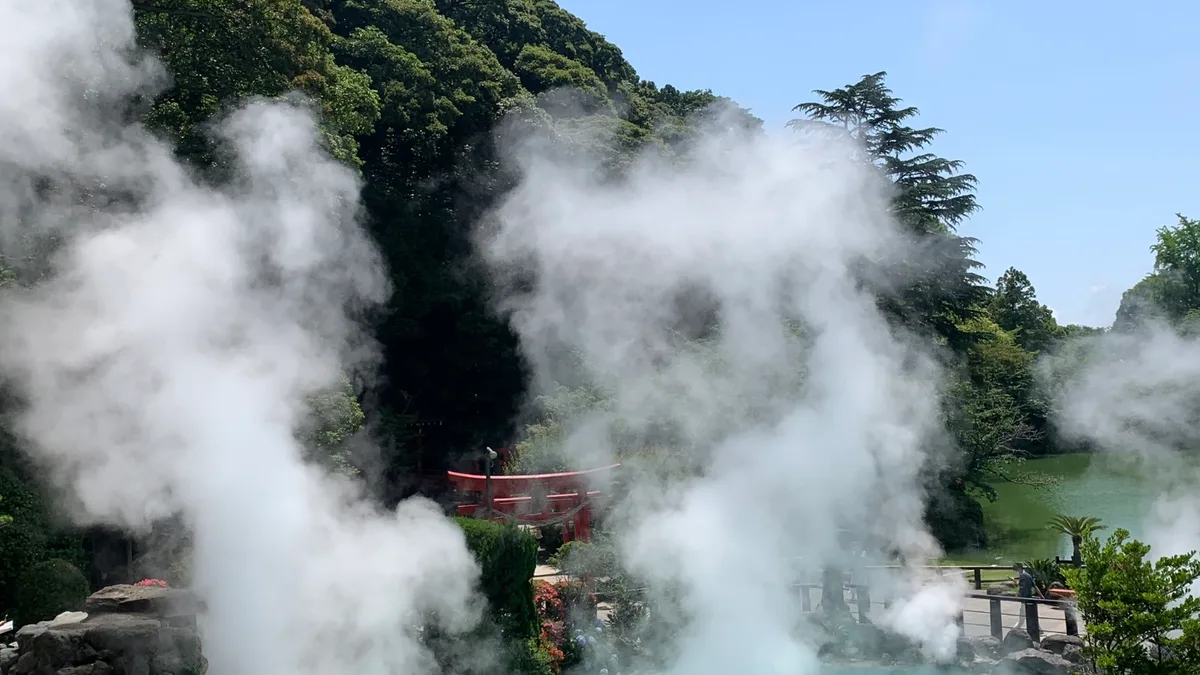
Beppu Onsen — The Town Where the Earth Boils Just Beneath Your Feet
An audio cultural guide to Beppu Onsen, verified against official sources. Understand why the 'hells' (jigoku) are hot springs you look at rather than bathe in, how steam becomes dinner in Kannawa, how the sand bath works, and how Japan's most concentrated hot-spring region turned a boiling earth into daily life.
Beppu Onsen (Kannawa)
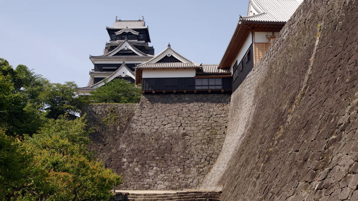
Kumamoto Castle — A Fortress Being Put Back Together, One Numbered Stone at a Time
An audio guide to Kumamoto Castle — a fortress still being rebuilt after the 2016 earthquake. The miracle stone wall, the elevated walkway over the live repair, plus hours, tickets and access.
Kumamoto Castle
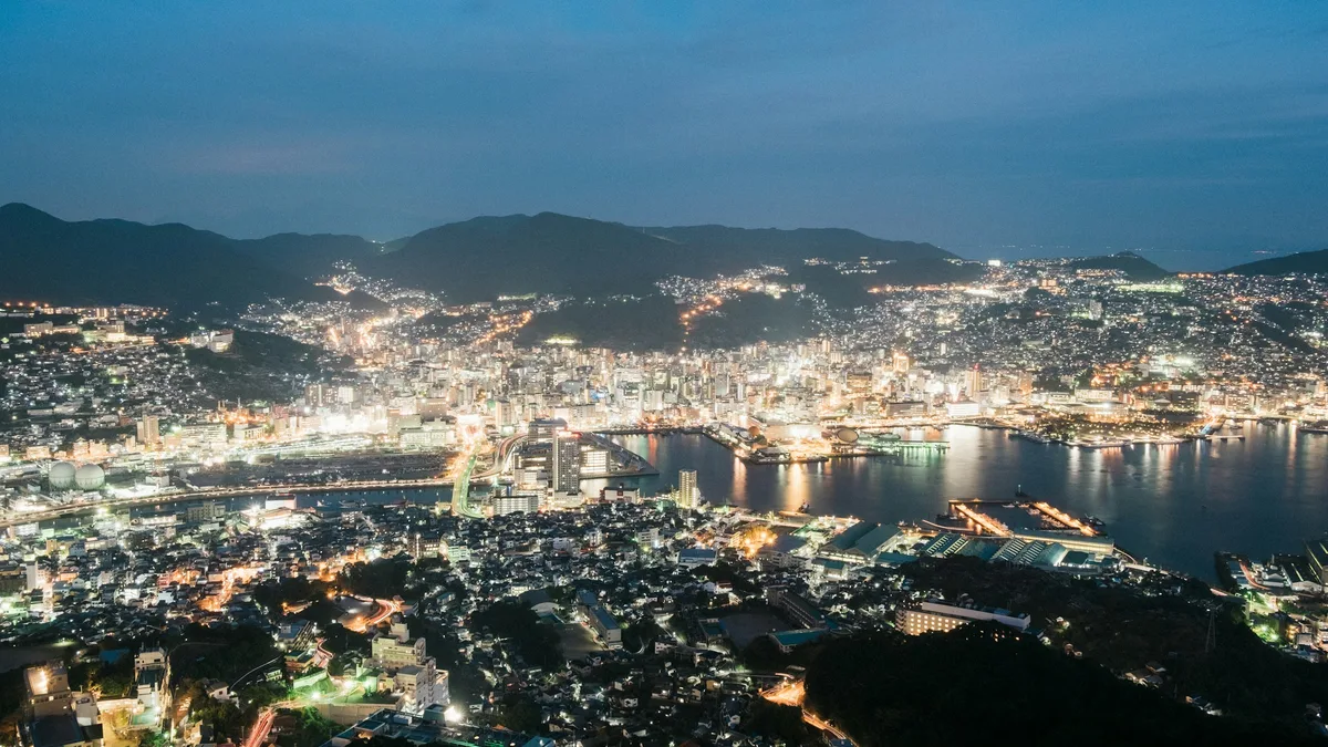
Nagasaki — The Port That Was Japan's One Open Window to the World
An audio guide to Nagasaki, Japan's one open window to the world — Dejima, Chinatown's champon, the Peace Park, Glover Garden, and the hillside night view.
Nagasaki